








4-5 thousand years ago in Ancient Egypt and China, people knew about underground waters, as evidenced by deep wells found in large cities. Mineral water treatment appeared in Asian countries. Three thousand years ago, great scientists of Ancient Greece and Rome, such as Thales and Aristotle, described the properties of underground waters and their role in the overall water cycle. At the same time, the Arab sage Al-Biruni suggested that springs could only gush if somehow connected to underground water reservoirs. The Persian researcher Karadi proposed drilling the earth to extract water. Based on all these facts, it can be assumed that hydrogeology originated in ancient times. Moreover, modern scientific research largely confirms the hypotheses of ancient sages.
In the Middle Ages, the study of underground waters was widely conducted in the territory of the former Roman Empire. Scientists actively participated in freshwater supply projects for territories adjacent to the Mediterranean Sea. This led to the development of the doctrine of artesian, confined, and unconfined waters. The concept of artesian waters also emerged. In Russia, all hydrogeological surveys were considered part of geology and were its integral component. The first scientific ideas about the location of underground waters were expressed by Lomonosov in the 18th century.
Hydrogeology in the USSR
In 1922, Russia became the Union of Soviet Socialist Republics. During this period, the first hydrogeological centers were formed. They actively implemented pre-Soviet knowledge obtained by Lomonosov, Krasheninnikov, and Severgin (who studied mineral waters). The most outstanding scientists of the era were Lebedev, Obruchev, Vasilevsky, Butov, Vernadsky, Pogrebov, Lange, Semikhatov, and Savarensky. Specialists organized hydrogeological research, studied the processes of groundwater movement in strata, compiled catalogs of boreholes, and developed hydrogeological exploration methods.
In the early 1940s, the USSR developed the doctrine of groundwater balance and identified patterns of their formation. Directions such as petroleum and cryohydrogeology were distinguished. In the 1950s, research continued, new methods of mapping and justification for the use of underground waters were created. Up to the 1970s, active work was carried out to combat water inflows in mining operations, experimental filtration studies were conducted, and consolidated hydrogeological maps were compiled. In the 1980s, mathematical modeling methods were widely used. During this period, Soviet sectoral institutes, laboratories, and corresponding university departments were actively established.
Directions of Hydrogeology
4-5 thousand years ago in Ancient Egypt and China, people knew about underground waters, as evidenced by deep wells found in large cities. Mineral water treatment appeared in Asian countries. Three thousand years ago, great scientists of Ancient Greece and Rome, such as Thales and Aristotle, described the properties of underground waters and their role in the overall water cycle. At the same time, the Arab sage Al-Biruni suggested that springs could only gush if somehow connected to underground water reservoirs. The Persian researcher Karadi proposed drilling the earth to extract water. Based on all these facts, it can be assumed that hydrogeology originated in ancient times. Moreover, modern scientific research largely confirms the hypotheses of ancient sages.
In the Middle Ages, the study of underground waters was widely conducted in the territory of the former Roman Empire. Scientists actively participated in freshwater supply projects for territories adjacent to the Mediterranean Sea. This led to the development of the doctrine of artesian, confined, and unconfined waters. The concept of artesian waters also emerged. In Russia, all hydrogeological surveys were considered part of geology and were its integral component. The first scientific ideas about the location of underground waters were expressed by Lomonosov in the 18th century.
Hydrogeology in the USSR
In 1922, Russia became the Union of Soviet Socialist Republics. During this period, the first hydrogeological centers were formed. They actively implemented pre-Soviet knowledge obtained by Lomonosov, Krasheninnikov, and Severgin (who studied mineral waters). The most outstanding scientists of the era were Lebedev, Obruchev, Vasilevsky, Butov, Vernadsky, Pogrebov, Lange, Semikhatov, and Savarensky. Specialists organized hydrogeological research, studied the processes of groundwater movement in strata, compiled catalogs of boreholes, and developed hydrogeological exploration methods.
In the early 1940s, the USSR developed the doctrine of groundwater balance and identified patterns of their formation. Directions such as petroleum and cryohydrogeology were distinguished. In the 1950s, research continued, new methods of mapping and justification for the use of underground waters were created. Up to the 1970s, active work was carried out to combat water inflows in mining operations, experimental filtration studies were conducted, and consolidated hydrogeological maps were compiled. In the 1980s, mathematical modeling methods were widely used. During this period, Soviet sectoral institutes, laboratories, and corresponding university departments were actively established.
Directions of Hydrogeology
Hydrogeology as a science includes a significant body of knowledge about underground waters. It studies the dynamics of underground waters, their chemical composition, information about the productivity of aquifers and their quality, which allows planning work for drinking or agricultural water supply.
For convenience, a classification was created that includes the following directions:
- Regional – study by various geostructures, search for new underground basins;
- Genetic – direction concerning thermal and saline waters located at horizons of different depths;
- Hydrodynamic – study of water movement directions, search for patterns of this movement, performing corresponding calculations, creating mathematical models;
- Hydrogeochemical – objects of study in this direction are the water composition and conditions of its formation;
- Paleohydrogeological – historical foundations of the formation and development of the science;
- Ecological – protection of groundwater.
What are groundwater?
Groundwater includes all waters in the Earth's crust that are located below the Earth's surface, not only in liquid but also in solid and gaseous states. All this is considered part of the Earth's hydrosphere. The total reserves of fresh groundwater amount to up to one-third of the entire World Ocean. In Russia, more than 3300 deposits have been discovered, with only 50% of them developed and actively exploited. They are used as sources of drinking water, for land reclamation, but can also cause landslides, soil subsidence, and mine flooding. Therefore, these deposits are not only developed but also drained if they pose a threat.
Distribution of water in the Earth's crust
Waters in the Earth's crust are located in two planes: the first or lower is formed by dense magmatic and metamorphic rocks, and the amount of water here is limited. In the second plane, sedimentary rocks predominate, and a large volume of water is contained here. This plane is divided into several levels:
- Upper – fresh: drinking, technical, and household;
- Middle – mineral with salts, trace elements, and biologically active substances;
- Lower – highly mineralized brines, in which many chlorides and sulfates are dissolved (accordingly, bromine, iodine, and table salt are extracted from them).
Groundwater is formed in various ways.
Infiltration
This is the seepage of atmospheric precipitation down to the impermeable layer (thus saturating porous rocks). About 20% of the total precipitation penetrates the soil and reaches the groundwater horizons. Thus, groundwater horizons or aquifers arise. This is the main formation method, closely related to the water cycle in nature.
The amount of water seeping into the soil depends on the physical properties (density) of the soils, terrain relief, and vegetation cover (the more plants, the better the process). The amount of infiltrated water will be greater during prolonged drizzle rather than during a heavy downpour.
Condensation of water vapors
Condensation of atmospheric water vapors occurs in rocks, thereby enhancing groundwater deposits.
Juvenile waters
These are waters released during the differentiation of a magmatic source. They are considered primary. Such groundwater does not exist in "pure" form in nature, as all of them mix with each other.
Classification of groundwater
There is the following classification:
- By types: perched water, sporadic, groundwater, confined (artesian), and permafrost groundwater;
- By occurrence conditions: pore, bedded, fractured.
- By mineralization degree: ultra-fresh, fresh, mineral, brackish, saline, and brines;
- By temperature: supercooled, cold, and thermal;
- Depending on quality: technical, mineral, and drinking.
Perched water
Perched water refers to groundwater located near the Earth's surface. They are unevenly distributed and have a seasonal existence. Usually, it appears in the "rainy season" and disappears during dry periods. Such an impermeable layer can reach the surface, resulting in swamp formation.
These waters are usually fresh, with low mineralization, but often contaminated with silicic acids, iron, and organic substances. Perched water cannot serve as a stable water supply source, so measures are taken for its artificial preservation during drought.
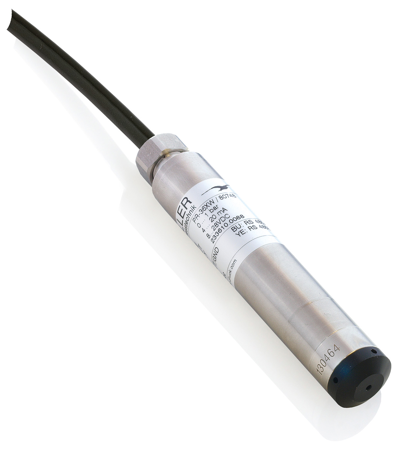
 High-precision autonomous level recorder – DCX-22
Groundwater
These are waters with regional distribution, located first from the surface, mostly unconfined, characterized by certain stability. However, their level fluctuates seasonally. Moreover, it depends on the amount of precipitation, terrain, and vegetation presence.
Artesian waters
They are located in an aquifer between impermeable layers. They are affected by hydrostatic pressure. Artesian waters are characterized by a constant flow rate. The recharge areas of artesian basins are distant from the extraction sites, and the size of these basins can reach 1000 km.
Soil groups by water permeability
Soil permeability is its water transmission capacity. Depending on this characteristic, the following are distinguished:
- Permeable soils, through which water passes easily (while it is filtered), are sand or gravel;
- Impermeable, with minimal ability to absorb water, are clay, marble, granite;
- Semi-permeable or those that absorb water limitedly – for example, loose sandstones and clayey sands.
Hydrogeological Basins
These are underground water basins, defined systems with common conditions of occurrence and geological-structural boundaries. They include:
- Artesian – accumulations of water with underground pressure layers;
- Groundwater – flow systems with defined hydrodynamic boundaries;
- Fracture waters: hydrogeological masses of karst, fracture, and fracture-vein waters;
- Underground runoff – a system of water flows with a common flow.
Hydrogeological Systems
They represent a combination of geological bodies where waters are interconnected and follow common movement laws. All components of the system can interact with each other through common boundaries (direct interaction), through other elements (indirect). It is also possible that elements enter the studied system through another system – such interaction is called indirect.
Additionally, systems are divided into those created solely by nature, i.e., natural, and natural-technogenic, which also include engineering structures.
Hydrogeology Today
The main focus of hydrogeology is the rational use of groundwater. The science studies the current state of underground water basins, chemical properties of water, the impact of construction of engineering structures, and human economic activities. Research is also conducted to study the interaction of groundwater with rocks and processes occurring within the aquifer thickness.
Hydrogeology remains inextricably linked with geology. The search for new hydrogeological basins and mineral water sources continues, and the properties of already discovered ones are studied. More valuable deposits are identified, with groundwater having unique chemical compositions (for example, with bromine or iodine). Scientific activity also involves organizing existing knowledge and searching for new development patterns.
_80x0_e6f.jpg "Pressure Transmitter Series 23SX-H2")
1)_80x0_e6f.jpg "Happy Defender of the Fatherland Day!")
_80x0_c25.jpeg "Radar Level Meter IZMERKON RL 37")