

Hydrometry is the science that studies water found in natural reservoirs. It examines, in particular, the processes of precipitation, as well as changes in water levels in lakes, rivers, underground aquifers, etc. Level monitoring plays a crucial role in hydrometry, as recording even minimal changes in water level is a primary task of hydrometric research. Hydrometry also often uses chemical analysis systems to measure water quality and detect any kind of pollution.
 Hydrometry specialists count the amount of water falling as rain to determine the volume of precipitation over specific periods. For these purposes, special precipitation sensors are used (for example, the Keller rain gauge). During rainfall or snowmelt, hydrometry data help forecast floods, determine water composition, and monitor the condition of streams and water levels in rivers. Lakes, underground aquifers, artificial reservoirs, or even oceans—all are objects of hydrometry study.
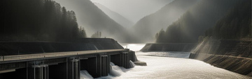
By analyzing precipitation processes, hydrometry allows predicting when water infiltrating the ground and merging with rivers and streams will cause floods. Data obtained from pressure transducers installed at level monitoring stations enable warnings about possible floods and control of dam and lock operations.
Rain Gauge or Pluviometer
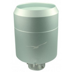
A device for measuring the amount and intensity of atmospheric precipitation in liquid (rain) or solid (snow, hail) form is called a rain gauge or pluviograph. The difference is that a pluviograph records precipitation continuously, while a rain gauge does so periodically. Professional rain gauges appeared relatively recently. In the 1970s, under the leadership of V. S. Golubev at the State Hydrological Institute, a method for correcting data obtained from rain gauges was developed. Studies and tests of various types of wind protection for domestic and foreign devices were conducted, resulting in the creation of a rain gauge with double intake protection, which became a standard for the World Meteorological Organization (WMO). This method was approved by the WMO and recommended for widespread use in 1998.
The first rain and snow sensor in the Tianchi basin was invented in 1247 by the Chinese mathematician and inventor Sun Qin Jiushao to collect meteorological data. In 1441, the first standardized rain gauge appeared in Korea, and in 1662 Christopher Wren, together with Robert Hooke, constructed the first tipping bucket rain gauge in the United Kingdom. However, rain gauges became available to domestic specialists only in the 1970s.
Classic Rain Gauge
A rain gauge is essentially a bucket placed horizontally on a special stand surrounded by wind protection. This is necessary so that the wind does not interfere with the even collection of precipitation. Collected precipitation is poured into a measuring cup, allowing determination of the water layer thickness in millimeters. The main elements of a classic rain gauge are: the rain collection bucket, which is mounted on a pole inside a slatted special wind shield, and the measuring cup designed to measure the collected precipitation. In winter, snow accumulates in the rain gauge bucket, and precipitation is measured after the snow melts.
Pluviometer
A pluviometer is a rain gauge with simple or no wind protection. It consists of a cylinder that collects precipitation over an area of 500 cm² and a Nipher shield—four iron sheets shaped like a funnel. Additionally, the pluviometer has another cylinder with a lid and a measuring cup. The pluviometer should be mounted on a pole at least two meters above the ground at a meteorological station. When working with a pluviometer, it is important to consider that wind can blow precipitation into or out of the cylinder. However, if the pluviometer is installed correctly, these occurrences will be rare. At standard meteorological stations, pluviometers should be placed in open areas protected from wind by trees or buildings, which should be no closer than twice their height from the pluviometer. Precipitation is measured at least twice a day—morning and evening—and additionally during the day if there was a downpour. When the pluviometer is full or during scheduled measurements, the cylinder is removed from the pole, covered with a lid, and replaced with a spare. The cylinder's spout is also covered with a cap. Indoors, all water is carefully poured from the spout into the measuring cup. In summer, this can be done near the pluviometer if it is not raining. To measure solid precipitation, the cylinder with the lid is taken indoors to warm up and wait for the snow or ice to melt, then poured into the measuring cup.
How Precipitation is Measured
The amount of precipitation is measured in millimeters, indicating the thickness of the water layer formed by the fallen precipitation if it does not evaporate or seep into the soil. The numerical value of precipitation is found by measuring the amount of water fallen on an area of 1 square meter, where 1 mm corresponds to 1 kg per 1 m². Rain is called "heavy" if the precipitation amount is from 15 to 49 mm within 12 hours. "Very heavy" precipitation is considered to be more than 50 mm in 12 hours.
The amount of snowfall precipitation, called "heavy snow," ranges from 7 to 19 mm in 12 hours. If the snowfall exceeds 20 mm in 12 hours, it is called "very heavy snow."
Meteorological observations are conducted with an assessment of precipitation intensity based on meteorological visibility range. Rain is considered "heavy" if visibility is less than 1000 meters, and snowfall is considered "heavy" if visibility does not exceed 500 meters.
Types of Precipitation Gauges
There are different instruments for measuring precipitation amounts (in meteorology and hydrology) - precipitation gauges. They operate on different principles, which affects their size, installation method, measurement range (maximum precipitation amount in millimeters), and maintenance costs. It is also important to consider that some precipitation gauges can measure not only liquid precipitation (rain) but also solid precipitation (snow, hail). It is also necessary to distinguish between meteorological instruments and hydrological instruments because the goals and results of atmospheric precipitation measurements may differ. Therefore, if you want to buy a precipitation gauge, pay attention to the search results. Specialists at "Izmerkon" will help you choose a rain gauge, as they have extensive experience in selecting, supplying, and installing precipitation gauges in various climates. We recommend precipitation measuring models that suit your measurement goals and operational resources. In most cases, customers use meteorological precipitation gauges with a tipping bucket or weighing mechanism. But there are also optical precipitation gauges, marine precipitation gauges for the sea that account for pitching, and tipping-weighing gauges. Besides precipitation gauges, there are also rain sensors that detect the presence of rain.
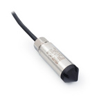
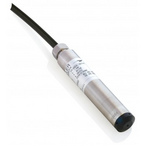
Hydrometry specialists conduct long-term monitoring of water levels in riverbeds to ensure optimal flow conditions. For example, when water is withdrawn, it is necessary to rely on level readings to avoid drying out the riverbed. The volume of withdrawn water will be determined by historical hydrometric measurement data. A submersible pressure transducer (for example, 36XW) is installed at the location where water passes through a dam. Monitoring data and information about the shape of the dam or channel allow the use of the level value to calculate the volume of water passing through the riverbed.
 In hydrometric studies of groundwater, hydrologists create maps of locations where water reserves are concentrated and from which water can be withdrawn for quality analysis. Submersible pressure transducers (for example, 26Y) are installed in special wells to measure groundwater levels, even at great depths. In surface lakes and artificial reservoirs, the sensor is submerged in water to a specified depth, after which, considering the shape of the reservoir, the volume of contained liquid can be calculated.
Sensors installed in rivers, lakes, and wells can be connected to autonomous data loggers. Such loggers are usually equipped with a GSM module that sends measurement results via e-mail (GPRS internet connection) or SMS. An example of such a logger is the Keller device GSM-2.
Level determination and water chemical analysis instruments are the main sensors used in hydrometry. Reliable and accurate hydrometric measurements provide information necessary for river protection, safe use of water resources, river navigation, and agriculture.
If you need to measure water level and require assistance in selecting the appropriate sensor, you can find a suitable device in our catalog or contact our specialists, and they will help you choose a sensor.
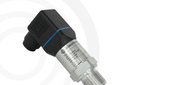
_80x0_e6f.jpg "Pressure Transmitter Series 23SX-H2")
1)_80x0_e6f.jpg "Happy Defender of the Fatherland Day!")
_80x0_c25.jpeg "Radar Level Meter IZMERKON RL 37")