Groundwater is a general term used to denote water that has penetrated underground and formed lakes and other aquifer formations there. Monitoring the groundwater level is carried out using special instruments in special measuring wells. Measuring wells are small-diameter wells used for monitoring groundwater and analyzing water quality.
 Aquifer formations are underground, water-filled reservoirs located above solid layers (e.g., rocky) that prevent water from penetrating deeper. However, unlike surface water bodies, the upper water level in such formations does not represent a flat surface, as the permeability of the soil above different parts of the formation varies. This circumstance complicates the process of measuring the level in natural underground reservoirs. The depth at various points of the aquifer formation can also differ; moreover, several aquifer layers may lie at different depths in the same area. It is precisely to obtain all this information that groundwater monitoring is conducted, for which measuring wells are created.
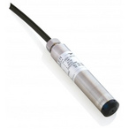
A well is a borehole in the ground with a pipe fixed inside it, equipped with a mesh filter, the end of which is lowered into the natural underground reservoir from which water is intended to be drawn. The water level in the pipe will rise and fall according to changes in the groundwater level, allowing monitoring. The level condition at the measurement site will be influenced by seasonal changes, soil permeability, and the scale of water extraction. By regularly recording data obtained from a submersible level transmitter, it is possible to establish the nature of groundwater level changes depending on precipitation amounts and water extraction scales.

By drilling several observation wells in a specific area, it is possible to monitor the groundwater horizon, i.e., the level across the entire aquifer formation area. In addition to measuring groundwater levels, measuring wells also allow monitoring the degree of groundwater contamination. Such contamination may result from chemical spills on the surface, overflow or leakage of the underground reservoir, as well as overuse of fertilizers on agricultural plots. All these pollutants can penetrate through the soil into the aquifer formation, causing a sharp increase in the level that cannot be explained by natural causes.
After water penetrates the soil, it can continue moving toward deeper or more distant reservoirs. For example, water that has penetrated the soil at the top of a hill may accumulate under that hill and then emerge on the surface in a lowland, forming a lake there. Due to groundwater flow, even sensors located in the same area can record differing level values. Thus, measuring wells can be used to monitor groundwater flow volumes and to determine how much water can be extracted without damaging the water resource.
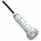
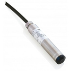
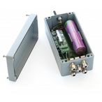
Thus, measuring wells are a key tool for monitoring and visualizing information about groundwater reserves and flows, controlling the entry of pollutants into the water, and preventing excessive use of the water resource. Experience shows that submersible transmitters and data loggers for level, due to their ease of installation and use, are key components of measuring wells.
You can familiarize yourself with various instruments for observation wells in the corresponding section of our catalog. For additional technical questions and purchasing inquiries, please contact our specialists.
_80x0_e6f.jpg "Pressure Transmitter Series 23SX-H2")
1)_80x0_e6f.jpg "Happy Defender of the Fatherland Day!")
_80x0_c25.jpeg "Radar Level Meter IZMERKON RL 37")